| The Plan of Chicago |
| Chicago in 1909 |
| Planning Before the Plan |
| Antecedents and Inspirations |
| The City the Planners Saw |
| The Plan of Chicago |
| The Plan Comes Together |
| Creating the Plan |
| Reading the Plan |
| A Living Document |
| Promotion |
| Implementation |
| Heritage |
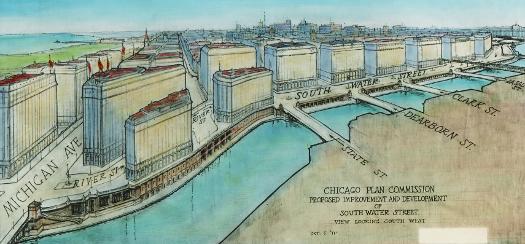
A remarkably prescient view of how the conversion of crowded South Water Street into what would become double-level Wacker Drive would open up the riverfront.
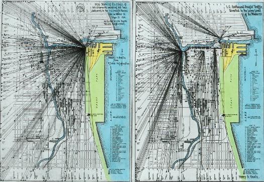
The major purpose of the lower level of the new South Water Street (Wacker Drive), as this slide illustrates, was to divert freight traffic from the downtown’s overburdened streets.
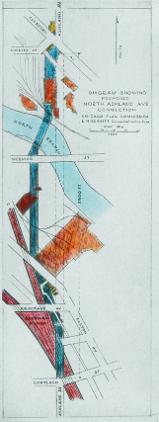
The Chicago Plan Commission observed that, as was the case on the South Side, there were relatively few continuous north-south streets on the North and West Sides. Among the proposals that were realized around 1930 were the widening of Ashland Avenue and connecting its separated sections from just north of Devon Avenue to 95th Street.
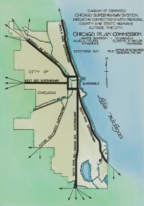
As this slide indicates, with the advance of the popularity of the automobile beyond the original planner's expectations, the Chicago Plan Commission was thinking of turning certain roads into "superhighways" in a manner that anticipated today's Interstate system.
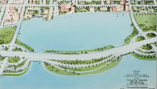
The Plan of Chicago recommended that a series of islands be constructed along the lakeshore north of downtown. Here that idea is combined with the proposed development of the Outer Drive between Foster Street and Bryn Mawr Avenue.
The Encyclopedia of Chicago © 2004 The Newberry Library. All Rights Reserved. Portions are copyrighted by other institutions and individuals. Additional information on copyright and permissions.