| Entries |
| P |
|
Planning, City and Regional
|
|
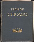
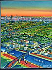
Burnham's call for an extensive lakefront park and a regional system of forest preserves was predated by Aaron Montgomery Ward's campaign to preserve Grant Park for public use and by the publication in 1904 of a report entitled “The Outer Belt of Forest Preserves and Parkways for Chicago and Cook County.” Although this latter document, edited by architect Dwight Perkins, was the first proposal for a regional network of parks, today's extensive system of parks along the shoreline of Lake Michigan and the 67,000-acre Cook County Forest Preserve system were both chiefly inspired by the Burnham Plan.
|
The Burnham Plan was the first to recognize a Chicago metropolitan region encompassing southern Wisconsin and northwestern Indiana, but its main distinction was its comprehensiveness. In addition to parks, Burnham gave detailed attention to the Loop and immediate environs and to the region's future highway system. Like others of his day, however, he failed to foresee the impact automobiles would have on American cities and their suburbs.
|
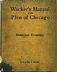
The publication of the Burnham Plan also led directly to the establishment of the Chicago Plan Commission and to a new department of city government, currently known as the Chicago Department of Planning and Development. Together, these two bodies have produced a number of important planning documents, including The Comprehensive Plan of Chicago (1966); The Lakefront Plan of Chicago (1972); and Chicago River Urban Design Corridor, volume 1, Downtown Corridor (1990); and volume 2, North Branch Riverwalk (1990).
|
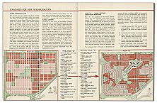
Simultaneously, another civic organization, known today as the Metropolitan Planning Council, spearheaded the passage of state legislation creating in 1957 the first regional comprehensive planning agency, the Northeastern Illinois Planning Commission (NIPC). This new agency subsequently prepared a number of plans covering the six Illinois counties of Cook, DuPage, Lake, Kane, McHenry, and Will.
|
The federal grant-making process also requires the existence of an approved long-range regional transportation plan and short-range capital program. To prepare these documents, a separate agency, the Chicago Area Transportation Study (CATS), was established in 1956 by means of a state and local government interagency agreement. The original CATS Transportation Plan (1962) proposed a network of new expressways for the inner third of the six-county region.

|
Today, each of the five counties outside Cook County also maintains its own comprehensive plan and, in some cases, separate transportation plans. Likewise, most of the region's 265 suburban municipalities maintain their own comprehensive plans, typically supplemented with capital improvement programs and ordinances regulating the use of private land and the protection of natural resources.
The Encyclopedia of Chicago © 2004 The Newberry Library. All Rights Reserved. Portions are copyrighted by other institutions and individuals. Additional information on copyright and permissions.