Within decades of the first locomotive's arrival in Chicago in 1848, the city became the nation's most important rail center. Railroads and related manufacturers centered their headquarters and production facilities in Chicago. Passengers and freight funneled into the city, which served as the principal transfer point between the nation's eastern and western rail lines.
Rees & Rucker Map of Chicago and Vicinity, 1849
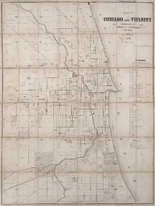
A line on this 1849 map marks the route of the first railroad in Chicago, the Galena & Chicago Union (1848), running west from the depot at Kinzie and Canal Streets, just northwest of Wolf Point at the fork of the Chicago River.
See also: Built Environment of the Chicago Region; Cook County; Mapmaking and Map Publishing; Mapping Chicago; Railroads
Chicago & North Western Railway Advertisement, 1869

Advertisement for the Chicago & North Western Railway, with daily trains to California and beyond, 1869.
See also: Development of Railroad Lines (Table); Chicago & North Western Railway Co.; Global Chicago; Railroads; Transportation
"Around the World" via the Chicago, Rock Island and Pacific Railroad, 1870
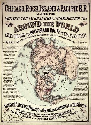
Chicago, Rock Island, and Pacific Railroad poster advertising "Around the World" travel via railway and steamer routes, 1870.
See also: Advertising; Business of Chicago; Railroads; Development of Railroad Lines (Table); Globalization (Digital Essay)
Railway Map of Chicago and Environs, 1879
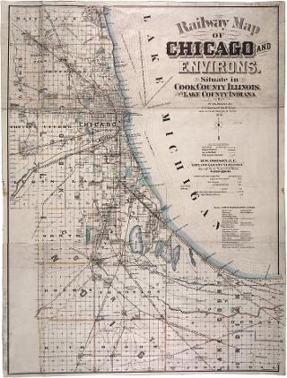
Railway Map of Chicago and Environs, 1879
See also: Railroads; Transportation; Development of Railroad Lines (Table); Railroad Pattern in 1950 (Map)
Map of Pullman Company Rail Network, 1885
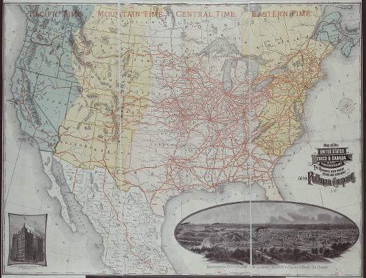
By 1885, the Pullman Company had already become one of America's largest and best-known firms. As this map, an advertisement for the company, shows, Pullman cars carried passengers from coast to coast and from Canada to Mexico. As a manufacturer of passenger and freight railroad cars, the Pullman Company was closely involved--financially and managerially--with most of the nation's railroads. The company had also begun to expand into Europe. By the end of the century, Pullman was one of America's largest companies as well as the country's single largest employer of African Americans, almost all of whom worked as Pullman porters, the most familiar symbol of the company and its service.
See also: Brotherhood of Sleeping Car Porters; Global Chicago; Innovation, Invention, Chicago Business; Pullman Inc.; Railroads
|
The Electronic Encyclopedia of Chicago © 2005 Chicago Historical Society.
The Encyclopedia of Chicago © 2004 The Newberry Library. All Rights Reserved. Portions are copyrighted by other institutions and individuals. Additional information on copyright and permissions. |