|
Gallery
|
| The Grid |
| Origins of the Grid |
| The River Breaks the Grid |
| Rationalization of Streets |
| Embracing / Rejecting the Grid |
| Transportation and the Grid |
The lines created by the surveyor's chain, though rigid, could not be completely inflexible. In some place nature breaks through. The Chicago River, one of the major factors influencing the geography, topography, and existence of Chicago, cuts irregularly through the rectilinear grid of the surveyors.
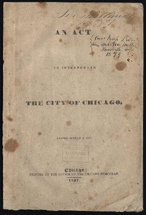
Act of Incorporation for the City of Chicago, 1837
|
|
|
The river divided the city into three districts: north, south, and west. The first city charter officially recognized these districts. The boards of public works, police, and assessors all consisted of representatives selected from each of these divisions. Beginning with the ward system established in that charter, and periodically redrawn in following decades, the river continued to serve as one of the major boundaries between representative legislative districts in the city. The y-shape on today's city seal memorializes the original three districts.
See also: Newspapers; "Downstate"; Government, City of Chicago; Home Rule; Municipal Charters; Ward System
Pere Marquette in tow on Chicago River at State Street Bridge
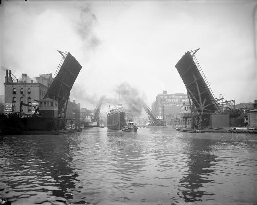
Bridges soon crossed the river, uniting the separate districts as much as possible. However, the river itself was a vital shipping and transportation route, so each bridge could become a "broken link" at any time, swinging or rising to let a ship pass.
See also: Bridges; Infrastructure; Transportation
Aerial view of main branch of Chicago River and surrounding area, 1951
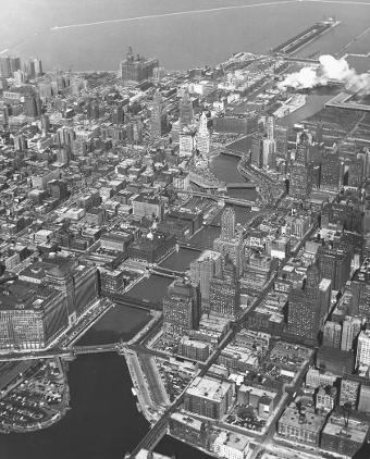
The curve of the river dictates the form of Wacker Drive, the only street in the city that has addresses with directionals for north, south, east, and west. In this photo looking east along the main branch of the Chicago River, Wacker Drive can be seen as it follows the south shore of the main branch before turning south at Wolf Point (in the lower left corner of the photo) to follow the east bank of the river's South Branch. The double-decked Wacker Drive, completed in 1926, initially extended west and south to Lake Street, where it became Market Street. In 1953, the City Council changed the name of Market Street to South Wacker Drive.
See also: Chicago River; Planning Chicago; Streets and Highways
|
The Electronic Encyclopedia of Chicago © 2005 Chicago Historical Society.
The Encyclopedia of Chicago © 2004 The Newberry Library. All Rights Reserved. Portions are copyrighted by other institutions and individuals. Additional information on copyright and permissions. |