| Entries |
| B |
|
Burnside
|
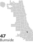 Community Area 47, 11 miles S of the Loop. Burnside, the smallest of Chicago's community areas, is bounded entirely by
railroads
—a distinctive and difficult-to-access triangle marked by the
Illinois Central Railroad
on the west, the Rock Island on the south, and the New York Central on the east. Interestingly, it occupies a different physical place from what earlier Chicagoans knew as Burnside, an area that lies almost entirely in the community areas of
Roseland
and
Chatham.
Only with the mapping of
University of Chicago
sociologists did the area once known as Stony Island and subsequently the Burnside Triangle become Burnside.
Community Area 47, 11 miles S of the Loop. Burnside, the smallest of Chicago's community areas, is bounded entirely by
railroads
—a distinctive and difficult-to-access triangle marked by the
Illinois Central Railroad
on the west, the Rock Island on the south, and the New York Central on the east. Interestingly, it occupies a different physical place from what earlier Chicagoans knew as Burnside, an area that lies almost entirely in the community areas of
Roseland
and
Chatham.
Only with the mapping of
University of Chicago
sociologists did the area once known as Stony Island and subsequently the Burnside Triangle become Burnside.
|
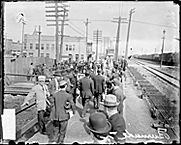
With their 400 homes and boardinghouses spread sparsely over the 30 blocks of Burnside, residents had to build many of their own institutions because city institutions, with the exception of Perry Public School, were located primarily west of the IC tracks. Two churches were among the most important: the Hungarians' Our Lady of Hungary Roman Catholic Church and the Ukrainians' Sts. Peter and Paul Church. These, along with the Burnside Settlement and the school, offered citizenship classes, educational programs, and a variety of other opportunities and services. Saloons, some with meeting halls, provided another venue where residents who lived in adjoining wooden homes and boardinghouses could meet.
Its well-defined physical boundaries (enhanced when the railroads were raised in the 1920s), small size, and residents' ethnic ties and common work experiences made Burnside a well-defined community socially in the years between the World Wars. They also meant Burnside attracted little outside attention. Even in the political arena, where it moved between the Ninth and Tenth Wards, it garnered little clout and few rewards.
Only after World War II did the vacant residential land in Burnside attract the attention of developers and potential new residents. New single-family homes began to appear, especially in the most northerly, undeveloped areas. Homes for the middle class, they gradually changed the nature of Burnside, first by class and then, beginning in the 1960s, by race, as middle-class African Americans built their own homes or occupied those of European-heritage residents who left the neighborhood. In the mid-1970s, Burnside, like other South Side neighborhoods, suffered from the scandals associated with Federal Housing Authority loans that led to a high number of foreclosures.
By the end of the twentieth century, Burnside had again become a comfortable residential community, still well defined by the railroads that created it and still underserved by the city outside its boundaries.
| Burnside (CA 47) | |||||
| Year |
Total
(and by category) |
Foreign Born | Native with foreign parentage | Males per 100 females | |
| 1930 | 3,483 | 37.1% | 53.7% | 109 | |
| 3,478 | White (99.9%) | ||||
| 5 | Other (0.1%) | ||||
| 1960 | 3,463 | 21.9% | 1.2% | 106 | |
| 3,454 | White (99.7%) | ||||
| 9 | Other races (0.3%) | ||||
| 1990 | 3,445 | 2.1% | — | 88 | |
| 57 | White (1.7%) | ||||
| 3,388 | Black (98.3%) | ||||
| 16 | Hispanic Origin* (0.5%) | ||||
| 2000 | 3,294 | 2.7% | — | 86 | |
| 47 | White alone (1.4%) | ||||
| 3,198 | Black or African American alone (97.1%) | ||||
| 1 | American Indian and Alaska Native alone (0.0%) | ||||
| 7 | Asian alone (0.2%) | ||||
| 4 | Some other race alone (0.1%) | ||||
| 37 | Two or more races (1.1%) | ||||
| 34 | Hispanic or Latino* (1.0%) | ||||
The Encyclopedia of Chicago © 2004 The Newberry Library. All Rights Reserved. Portions are copyrighted by other institutions and individuals. Additional information on copyright and permissions.