| Historical Source |
| M |
|
Map of Chicago and Additions, 1836
|
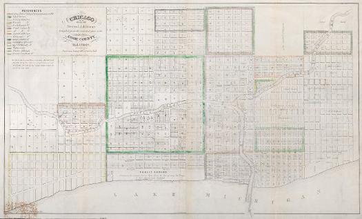
Created by the Illinois and Michigan Canal commissioners and recorded on July 2, 1836, this map mandates that a portion of the lakeshore be dedicated as "Public Ground. A Common to remain forever Open, Clear, & free of any buildings, or other Obstructions Whatever." Named Lake Front Park, this area was bounded by Randolph Street to the north, Madison Street to the south, Michigan Avenue to the west, and the lake to the east.
The Electronic Encyclopedia of Chicago © 2005 Chicago Historical Society.
The Encyclopedia of Chicago © 2004 The Newberry Library. All Rights Reserved. Portions are copyrighted by other institutions and individuals. Additional information on copyright and permissions.
The Encyclopedia of Chicago © 2004 The Newberry Library. All Rights Reserved. Portions are copyrighted by other institutions and individuals. Additional information on copyright and permissions.