|
Gallery
|
| The Grid |
| Origins of the Grid |
| The River Breaks the Grid |
| Rationalization of Streets |
| Embracing / Rejecting the Grid |
| Transportation and the Grid |
Giving directions for getting from one place to another is made simpler with a grid system, but its straight lines do not always provide the quickest trip between two points. More direct transportation corridors both predated and outlasted the imposition of the grid pattern. Remnants of trails that either sought high ground or required the shortest portage remain as diagonal shortcuts and major transportation arteries. In some cases, however, new transportation corridors were imposed on top of the grid pattern of city and suburban streets.
Bird's Eye View of Elevated Railroads, Parks and Boulevards, 1910
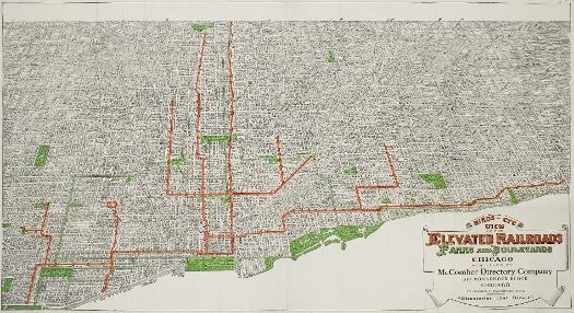
Although situated literally above the grid, elevated trains in fact followed its pattern quite closely. The expense of buying or condemning land in order to cross over property was doubtless a major reason for the consistent "alley routes" taken by the elevated, which necessitated including multiple sharp turns in the track. Later both elevated and ground-level lines followed diagonal routes, including the Blue Line with its long stretches along Milwaukee Avenue and down the center of the Kennedy Expressway, and the Orange Line that parallels portions of Archer Avenue.
See also: Commuting; Mapmaking and Map Publishing; Public Transportation; Rapid Transit System; Chicago's Rapid Transit Lines (Map)
Existing and proposed highways in the metropolitan region, c.1926
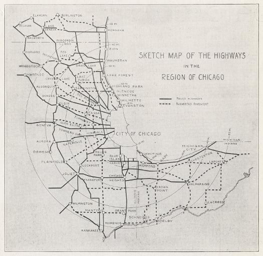
In 1926, the Chicago Regional Planning Association published a study of Highways in the Region of Chicago, concluding, "The one cure for traffic congestion is to build wider roads and more of them." A sketch map included in the booklet showed "paved highways" and "suggested pavement." Instead of a grid, the overall pattern is one of spokes of a wheel.
See also: Governing the Metropolis; Government, City of Chicago; Planning Chicago; Streets and Highways; Chicago-Area Expressways, 2003 (Map)
Highway Map of Cook County, 1970
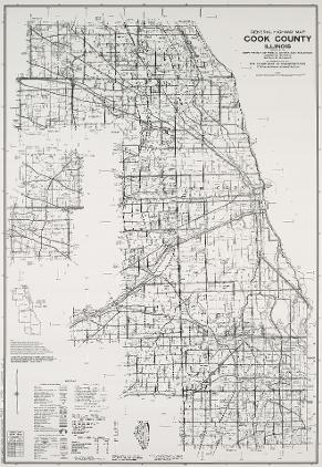
By 1970, the interstate highway system was well-established. Major highways can be seen snaking through the landscape seemingly without regard to the grid, though the entrances and exits remain tied to major roads, many of which sit on old township lines.
See also: Commuting; Cook County; Expressways; Transportation; Chicago-Area Expressways, 2003 (Map)
|
The Electronic Encyclopedia of Chicago © 2005 Chicago Historical Society.
The Encyclopedia of Chicago © 2004 The Newberry Library. All Rights Reserved. Portions are copyrighted by other institutions and individuals. Additional information on copyright and permissions. |