| Historical Source |
| T |
|
Thompson's Plat of 1830
|
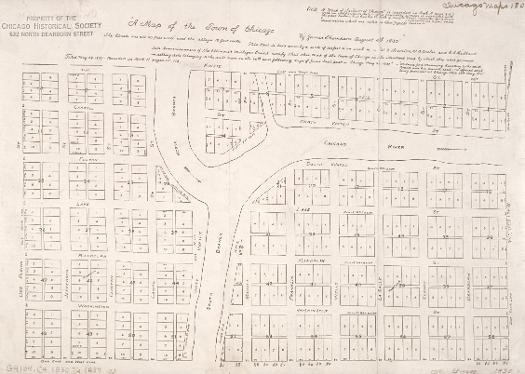
The Illinois and Michigan Canal Commissioners hired James Thompson, a surveyor from Kaskaskia in downstate Randolph County, to create Chicago's first plat (or map showing proposed lots) in 1830. He laid out the town with straight streets uniformly 66 feet wide (the length of a surveyor's chain) with alleys 16 feet wide bisecting each block.
The Electronic Encyclopedia of Chicago © 2005 Chicago Historical Society.
The Encyclopedia of Chicago © 2004 The Newberry Library. All Rights Reserved. Portions are copyrighted by other institutions and individuals. Additional information on copyright and permissions.
The Encyclopedia of Chicago © 2004 The Newberry Library. All Rights Reserved. Portions are copyrighted by other institutions and individuals. Additional information on copyright and permissions.