
|
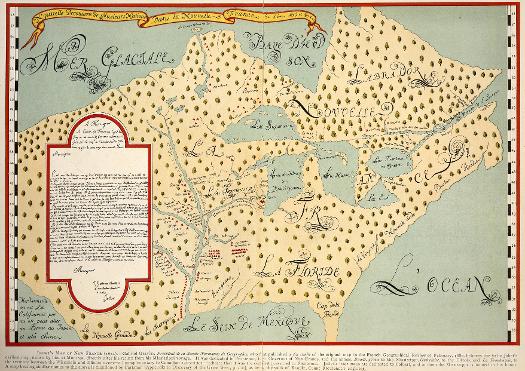
Scholars believe that the original version of this map was drawn by fur trader Louis Jolliet immediately after his 1673 excursion with Jesuit missionary Jacques Marquette. Jolliet and Marquette had travelled south from the Great Lakes on the Wisconsin and Mississippi (Buade on this map) Rivers to present-day Arkansas, then back north via the Illinois (Outrelaize) and Chicago Rivers to Lake Michigan. The map was dedicated to Frontenac, royally appointed governor of New France. |
||
|
The Electronic Encyclopedia of Chicago © 2005 Chicago Historical Society.
The Encyclopedia of Chicago © 2004 The Newberry Library. All Rights Reserved. Portions are copyrighted by other institutions and individuals. Additional information on copyright and permissions. |
||